
Map-based area selection
Draw a search area anywhere on Earth by placing a zone on the map, or drag a rectangle over terrain, coastline, or a city.

TopoLines is a web app for generating topographic contour line art from real elevation data. It lets users draw an area on the map, adjust contour styling, and export SVG or PNG files for design or print workflows.
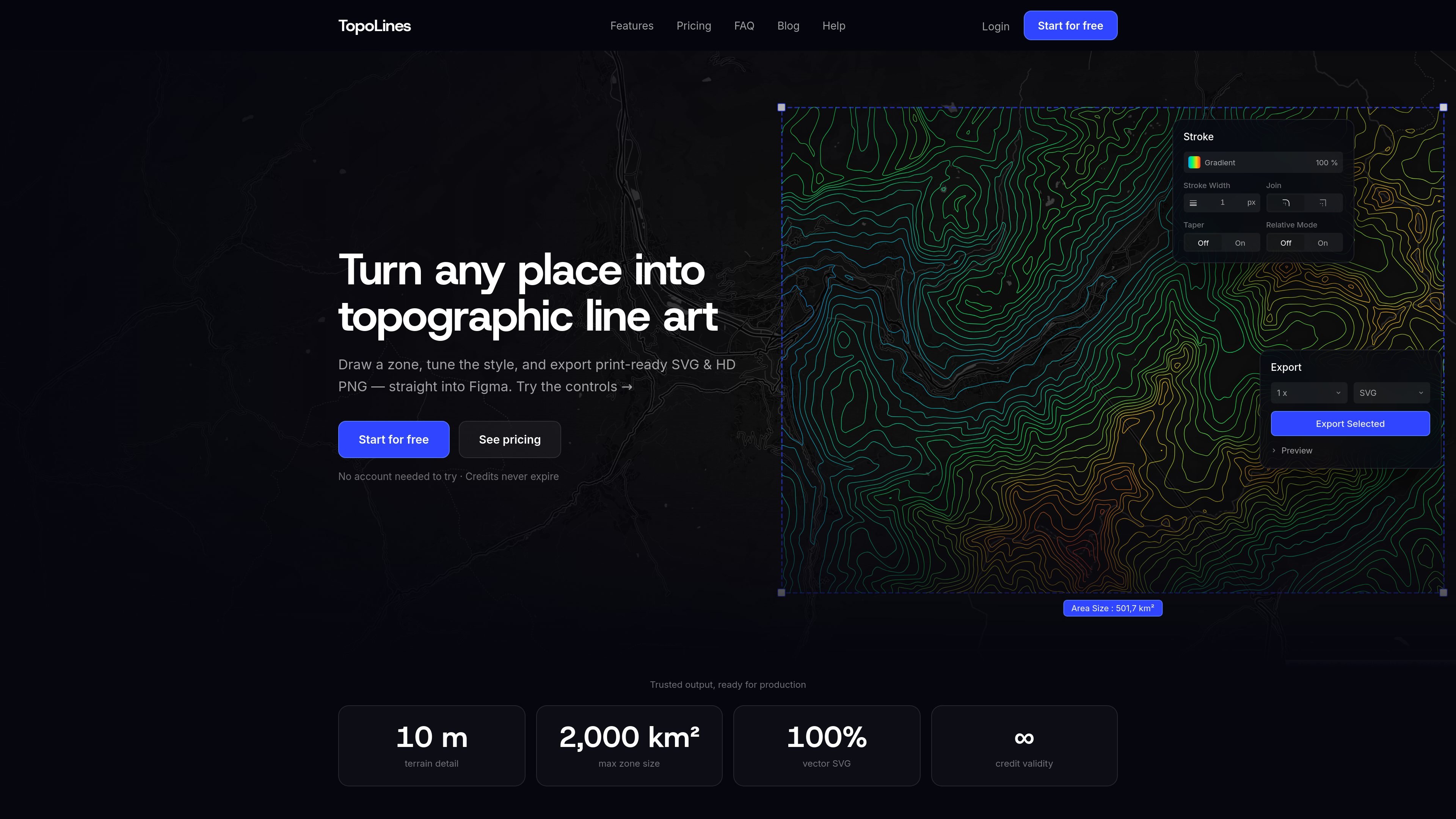
TopoLines is an online topographic map generator for turning real elevation data into contour line art. You select an area anywhere on Earth, tune the contour styling, and generate layered output ready for design or print workflows.
The app supports both quick drafts and higher-detail exports by offering standard 30 m SRTM terrain and higher-resolution 10 m GeoTIFF terrain. It also includes batch workflows for multiple zones, clipboard export, and SVG output that can be opened in design tools such as Figma or Illustrator.
Draw a search area anywhere on Earth by placing a zone on the map, or drag a rectangle over terrain, coastline, or a city.
Adjust contour interval, stroke color or elevation gradient, line weight, taper, and relative mode before exporting.
Choose between standard 30 m SRTM terrain and high-resolution 10 m GeoTIFF terrain for finer contour detail.
Export as print-ready SVG or HD PNG, or copy SVG/PNG directly to the clipboard for use in design software.
Group several zones and export them together, with each area named by its nearest city.
Use flatten mode to merge contours into a single SVG path for easier import into Figma or Illustrator.
Create contour-line artwork for posters, wall prints, or other graphic pieces where the terrain itself is the visual subject.
Prepare editable SVG contour maps for layout work in Figma or Illustrator, with grouped layers that can be adjusted after export.
Generate quick geographic drafts using the standard 30 m terrain option when speed matters more than fine detail.
Build several region studies at once and export them in a batch when comparing different locations or making a themed set.
Apply gradient color, taper, and relative mode to emphasize local relief and create a more layered appearance in the final map.
TopoLines generates topographic contour line art from elevation data. You draw or search for an area on the map, adjust the contour styling, and export the result as SVG or PNG.
The app supports print-ready SVG exports, HD PNG exports, and clipboard copy for use in design tools such as Figma. The app also mentions export workflows that work with Illustrator because the SVG output is layered and editable.
Yes. The app shows support for multiple zones and batch export on the Pro plan, so you can create several areas on the map and export them together.
The source shows a free tier and a pay-as-you-go Pro plan. The pricing page itself is not available, so detailed prices and pack sizes are not confirmed in the source provided.
The app notes that you can create an account to get a Figma API key, but the source does not describe any broader third-party integrations beyond export and clipboard workflows.
PixelDrive is a bulk image generation API for creating many on-brand images from one template through a browser editor, REST API, CSV batch, or MCP. It suits teams that need repeatable image output with cacheable renders and usage-based pricing.

imgcook is a design-to-code tool that converts design drafts into front-end code. It supports plugin-based and developer workflows for Sketch, Photoshop, VS Code, and CLI usage.

Napkin AI는 텍스트를 편집 가능한 시각 자료로 바꿔 프레젠테이션, 문서, 공유용 콘텐츠 제작을 돕습니다. 텍스트 우선 생성과 협업, PPT·PNG·SVG·PDF 내보내기를 지원합니다.

Beautiful.ai is an AI presentation platform for individuals, teams, and enterprises. It helps users create branded slide decks with Smart Slides, collaborative editing, and export options while reducing manual formatting work.

Refero MCP for AI agents connects an MCP-compatible agent to Refero’s curated library of web and iOS product interfaces and user flows. It helps agents research real design patterns before generating UI, with access included in the Refero Pro plan.

Frames로 프리미엄 디바이스 프레임과 템플릿을 활용해 런치 포스터, 인스타그램·트위터·Product Hunt 마케팅 그래픽을 빠르게 제작하세요. 무료로 시작