WindSite
WindSite is an AI-powered platform providing rapid, pre-permit feasibility assessments for complex offshore wind energy projects.
What is WindSite?
What is WindSite?
WindSite is a cutting-edge Software as a Service (SaaS) platform engineered specifically for the offshore wind energy sector. Its core mission is to drastically accelerate the initial feasibility and pre-permit assessment phases of new wind farm developments. By leveraging advanced Artificial Intelligence (AI) and machine learning algorithms, WindSite synthesizes vast amounts of geospatial, environmental, and engineering data to deliver actionable insights faster and more accurately than traditional manual methods.
This platform serves as a critical decision-support tool for developers, investors, and regulatory bodies. It minimizes early-stage risk by identifying potential constraints—such as proximity to shipping lanes, protected marine areas, or complex seabed conditions—before significant capital is committed to detailed site surveys. WindSite transforms months of preliminary analysis into actionable reports within days, enabling faster project progression toward final permitting.
Key Features
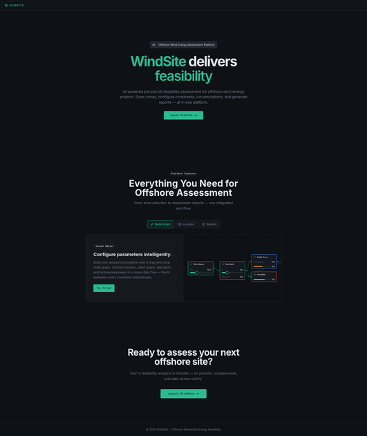
- AI-Powered Constraint Mapping: Utilizes proprietary machine learning models to instantly overlay and analyze regulatory exclusion zones, environmental impact areas (e.g., bird migration routes, marine mammal habitats), and maritime traffic density.
- Rapid Feasibility Scoring: Generates a comprehensive, quantitative feasibility score for any proposed site based on weighted criteria relevant to permitting success and economic viability.
- Geospatial Data Integration: Seamlessly ingests and processes diverse data layers, including bathymetry, existing infrastructure maps, meteorological data, and national/international maritime boundaries.
- Turbine Layout Optimization Suggestions: Provides initial, high-level recommendations for optimal turbine placement based on wake effects, water depth constraints, and accessibility for future maintenance.
- Automated Reporting: Produces standardized, exportable pre-permit assessment reports ready for internal review or preliminary submission to regulatory agencies, saving significant documentation time.
- Dynamic Scenario Testing: Allows users to adjust key parameters (e.g., turbine size, exclusion buffer distances) to immediately visualize the impact on the overall project feasibility score.
How to Use WindSite
Getting started with WindSite is designed to be intuitive, focusing on rapid deployment of initial site assessments:
- Define Project Area: Users upload or draw the preliminary boundary coordinates (shapefile or WKT format) for the proposed offshore wind farm location.
- Input Project Parameters: Specify high-level project requirements, such as target capacity, preferred turbine class, and any known local constraints or preferences.
- Data Ingestion & Analysis: WindSite automatically pulls relevant, up-to-date geospatial data layers from its integrated database and runs the proprietary AI assessment models against the defined area.
- Review Dashboard: Access the interactive dashboard displaying the overall feasibility score, detailed constraint heatmaps, and identified high-risk zones.
- Generate Report: Finalize the assessment by customizing the report parameters and exporting the comprehensive pre-permit feasibility document for stakeholder review.
Use Cases
- Early-Stage Developer Screening: A new renewable energy developer needs to quickly evaluate 15 potential sites across a large coastal region to select the top 3 for detailed environmental impact studies. WindSite screens all 15 sites in under 48 hours, prioritizing those with the fewest regulatory conflicts.
- Investment Due Diligence: An investment firm requires rapid validation of a target acquisition's proposed site viability before committing to the next funding round. WindSite provides an independent, data-driven assessment of permitting risk associated with the site's location.
- Grid Connection Planning: Project managers use the platform to assess how proximity to existing subsea cables or planned grid infrastructure impacts the feasibility score, guiding decisions on optimal export cable routes.
- Stakeholder Consultation Preparation: Before initial public consultations, project leads use the constraint maps generated by WindSite to proactively address known environmental sensitivities or conflicts with commercial fishing zones, improving community relations.
- Repowering Feasibility: Existing offshore wind operators looking to replace older turbines with larger, more efficient models use WindSite to quickly check if the new turbine footprint or wake effects violate any newly implemented local regulations or environmental buffers.
FAQ
Q: How current is the geospatial data used by WindSite? A: WindSite maintains a rolling update schedule for critical datasets, including maritime boundaries and environmental designations, ensuring that data is typically current within the last 6-12 months, depending on the specific data source's release cycle. Users are always notified of the data cut-off date for their specific assessment.
Q: Can WindSite handle complex, multi-jurisdictional project areas? A: Yes. The platform is designed to accurately delineate and analyze overlapping national, regional, and international maritime zones, providing a unified constraint analysis across complex boundaries.
Q: What level of customization is available for the feasibility scoring weights? A: While the default scoring weights are optimized based on industry benchmarks, advanced enterprise users have the ability to adjust the weighting factors for specific constraints (e.g., prioritizing seabed stability over bird migration routes) to align with their specific corporate risk appetite.
Q: Is WindSite a replacement for full Environmental Impact Assessments (EIA)? A: No. WindSite is explicitly designed for pre-permit feasibility assessment—the initial screening phase. It identifies high-risk areas that require detailed, on-the-ground investigation, thereby streamlining the subsequent, more expensive EIA process.
Q: What technical expertise is required to operate the platform? A: WindSite is built for accessibility. Basic proficiency in GIS concepts is helpful but not required. The platform's interface is designed for energy professionals who need results, not complex geospatial software operation.
Alternatives
Shengsuanyun
Shengsuanyun offers cloud-based solutions for efficient data management and analytics.
Ranpo AI
Ranpo AI offers automated risk assessment for rental listings, helping property managers and landlords identify potential issues before they arise. It streamlines the screening process by analyzing various data points to ensure tenant suitability and property safety.
DataFast
DataFast is an analytics tool designed for entrepreneurs, helping them understand which marketing channels drive revenue and how to optimize their business growth.
Biji
Biji is a versatile platform designed to enhance productivity through innovative tools and features.
Planndu: Daily Task Planner
Planndu is an intuitive productivity application designed to help users organize tasks, manage projects, build routines, and enhance focus using tools like AI generation and a built-in Pomodoro timer.
VForms
VForms enables the creation of interactive questionnaires overlaid directly onto YouTube videos, allowing users to collect highly contextual feedback and deep user insights.