
Smarter alert scoring
Scores each alert using real severity, actual proximity, and a personal Risk Profile, so the app can prioritize warnings that matter most to the user instead of treating every alert equally.

Weather Belt: Radar & Alerts is a weather intelligence app for iPhone and iPad that combines radar, official alerts, offline maps, and emergency tools. It prioritizes warnings by severity, proximity, and a personal risk profile, with no subscription or account required.
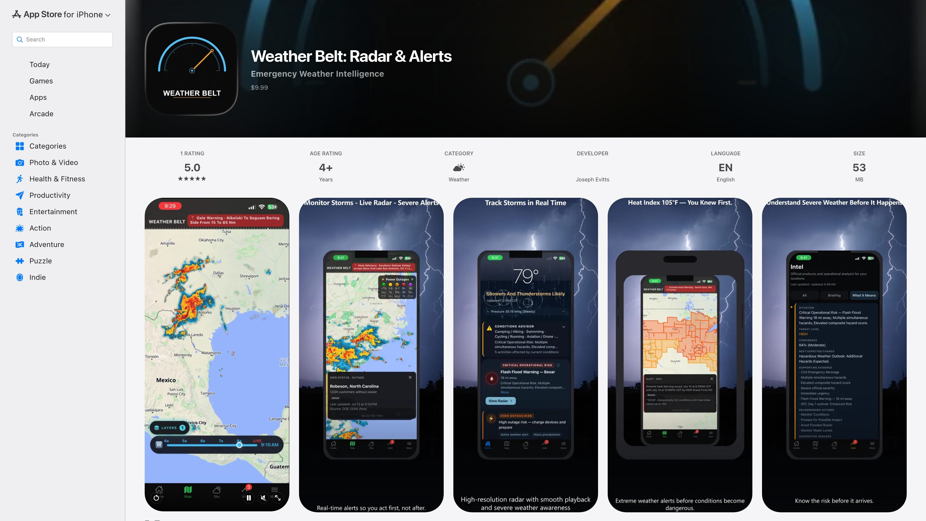
Weather Belt: Radar & Alerts is an emergency weather intelligence app for iPhone and iPad. It combines radar, official alerts, offline maps, and live hazard layers so users can see what is happening now and what is likely to matter next.
The app is built around alert interpretation rather than alert volume. It scores alerts by severity, proximity, and a user-defined Risk Profile, then pairs that with radar, storm analysis, hurricane tracking, and emergency tools for people who want a more structured view of severe weather.
Source text also describes privacy-focused operation: no account is required, no ads are shown, and the app says it collects zero personal data. The app is listed in the Weather category and is offered as a one-time purchase.
Scores each alert using real severity, actual proximity, and a personal Risk Profile, so the app can prioritize warnings that matter most to the user instead of treating every alert equally.
Shows live NEXRAD radar animation and NWS alert polygons, with automatic surfacing of active alerts such as tornado warnings, flash flood emergencies, and severe thunderstorm watches.
Lets users download Emergency Region Packs ahead of time, including offline map tiles for an area, so the map remains usable when connectivity drops.
Combines ten live data layers on one map, including lightning strikes, wildfires, seismic activity, marine buoys, aviation METARs, river gauges, air quality, and hurricane tracks.
Includes live emergency scanner audio streams from thousands of agencies nationwide via OpenMHz, with no account required.
Provides a home screen view with animated sky backgrounds, current conditions, a 12-hour hourly forecast, barometric pressure monitoring, and detailed condition metrics such as UV Index and dew point.
Users who want severe-weather alerts filtered by how serious they are and how close they are, rather than having to interpret a long list of warnings on their own.
People preparing for storms or outages who want radar, offline map tiles, and emergency templates available even when cell coverage is unreliable.
Users tracking multiple locations, such as family members or other people they are responsible for, can use the app’s location-based alert handling to keep an eye on different areas.
Anyone comparing radar, lightning, wildfire, river, air quality, hurricane, and aviation data from one screen instead of switching between separate apps or websites.
People who want emergency scanner audio inside the same app can listen to police, fire, EMS, and emergency operations streams without creating an account.
It is an iPhone and iPad app that combines radar, weather alerts, offline map packs, live data layers, and emergency tools in one place. The app emphasizes alert prioritization by severity, proximity, and a personal risk profile.
The source describes one-time purchase language and states there are no subscriptions, no ads, and no accounts. It also says the app collects zero personal data.
Yes. The app says critical alerts can break through Do Not Disturb, and the alert display cycles across active counties so severe weather is surfaced automatically.
The app includes emergency region packs with offline map tiles, so the map can keep working during outages, dead zones, and disasters after you download the area in advance.
Yes, the app includes live emergency scanner audio streams powered by OpenMHz, and the source notes an optional premium scanner integration via Broadcastify for power users.

MacSpoof es un cambiador de MAC para macOS: cambia o aleatoriza tu MAC Wi‑Fi para reconectar y reducir el registro de identidad en redes públicas.

NomNak es una app gratuita para iPhone para descubrir restaurantes con recomendaciones de amigos, guardar lugares, crear tu pasaporte gastronómico y buscar ciudades.

TyeGit es un cliente Git nativo para desarrolladores que buscan control rápido y preciso de staging, commits, ramas y remotos en Windows, macOS y Linux.

Loomal is a payments layer for agentic commerce that lets developers add paywalls to APIs, MCP tools, or hosted files. It settles agent payments in USDC on Base and is aimed at services that want per-request payment from AI agents.

idmly converts self-contained HTML designs into editable Adobe InDesign (.idml) files. It is built for designers and teams that need browser-made or AI-generated layouts turned into InDesign without rebuilding them by hand.

Rokoko is a motion capture software and hardware ecosystem for body, finger, and face animation. Rokoko Studio processes capture data, lets creators clean and retarget it, and streams or exports it to 3D tools.